If you are not interested in introductory remarks you may jump directly to the project procedure.
The daily course of the sun austerely influences our life. Nevertheless, most people are hardly familiar with it. It is the goal of this project to motivate the participants to perceive the sun's path above the horizon with awareness and to become familiar with the related phenomena on earth (the motion of shadows, the length of the days, seasons, points of sunrise or sunset at the horizon and the relation between local time and time zone, for instance). Thereby, they will experience phenomena which are caused by the rotation of the earth, by the inclination of its axis and by its yearly run around the sun.

| .gif)
|
|---|---|
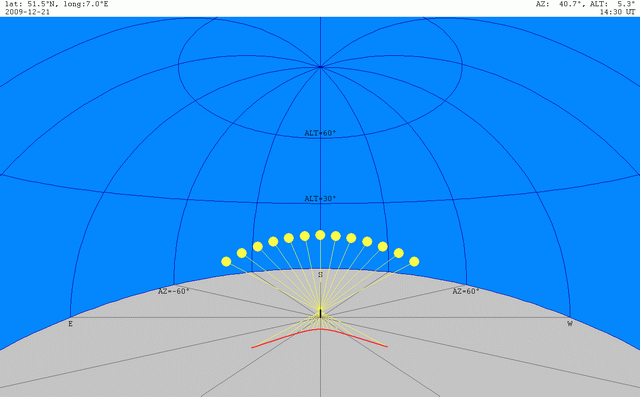
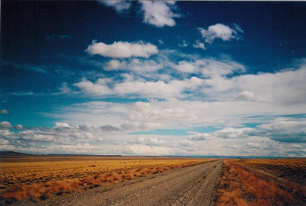
| A typical run of the sun during one day | The same run looking eastwards and the path of the shadow caused by the sun |
The sun rises at the eastern horizon, achieves its extremal elevation in the south (in the north if you live on the southern hemisphere) and sets in western direction. The variation of shadows on earth is closely related to this path of the sun: In the morning, all buildings, trees, ... have long shadows which point westward, at noon, their shortest shadows point to north (south) and so on. This fact offers the possibilty of observing the sun's path without directly looking at the sun which may be very dangerous for your eyes.
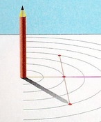
Following the sun's path by observing and registering the shadow of a fixed object exposes its variation in the course of days and months to view.
 |
 |
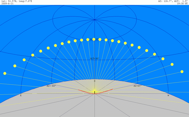 |
| Variations of the sun's path in the course of the year | ||
|---|---|---|
| December, 21th | March, 21th | June, 21th |
By observing and measuring of shadows it becomes additionally possible to compare the own observations with those of distant observers. In this way, you may experience that distant observers at the same time see the sun at different position at the sky.
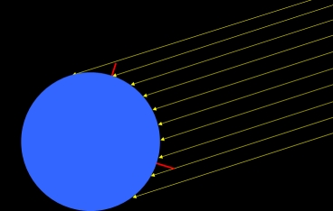
Because they all observe the same sun the light of which is parallel all over the world proves that the mutual horizons must have different orientations: We do not live on a flat plain! Of course, nowadays each child "knows" that the earth is a ball. But is every child (and every adult!) really convinced of that fact? Does she/he know any arguments for it?
 |
 |
|---|---|
| The earth | |
| Inside view | External view |
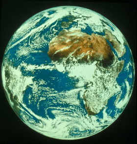
It is difficult to make own experiences which prove the spherical shape of the earth or, at least, show that it is "rounded". Though satellites send photographs showing the earth as a round disk, do those pictures really show a ball? And, even more important: Do they show our own domicile?
This project offers the possibility of experiencing the earth as a ball by own observations. Moreover, the paricipants will contribute their own results to get a good measure of the earth's radius and to prove that this radius has the same value all around the world. That means they will prove by international cooperation:
The earth is really a (nearly perfect) sphere!
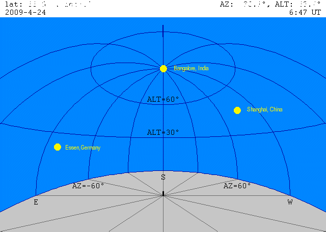
If people simultaneously look at the sun from different locations they will observe the sun at different positions above the horizon. If you know that the earth is a ball you can easily understand that different observers see the sun in different directions above their horizons. Viceversa, it is possible to determine the shape of the earth by simultaneously measuring the angle between the sunlight and the surface!
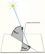
We will measure the sun's position, that means its direction relative to south or north (azimuth A) and its elavation (altitude h), by marking the top of the shadow of a vertical pole (gnomon). In principle, you can take a sharp pencil as a gnomon. But because of its blurring, it is better to use a pinhole as the pole's top. Details of the use of a pinhole are described in a seperate document.
Of course, the sun is simultaneously visible only from cities on the dayside of the earth. Therefore, we have chosen such a moment that people living in countries as possible can take part. The project's central point of time is
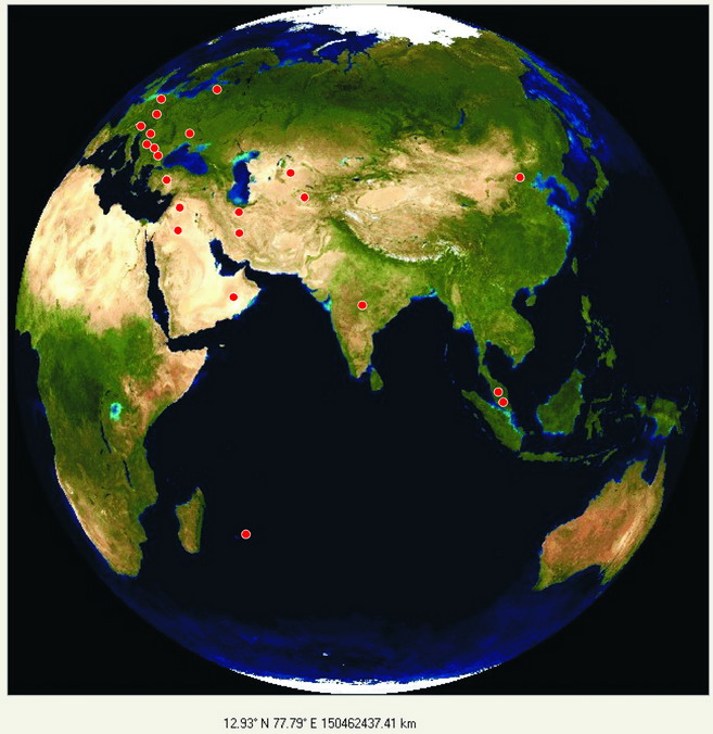
The earth's dayside on April 24th, 2009, 6.47 UT
The dots mark the positions of all sites taking part in this project.
This and the following maps and the corresponding table will be actualized continuously.
At that moment, the sun will be perceived to be directly overhead in Bangalore, India. Or: Bangalore will be the momentary sub-solar point. That is a very suitable fact because it therefore becomes easy to let calculate the distance between the own site and the sub-solar point. With this distance, it will be easy to derive the earth's radius from the own measured position of the sun. For details look here.
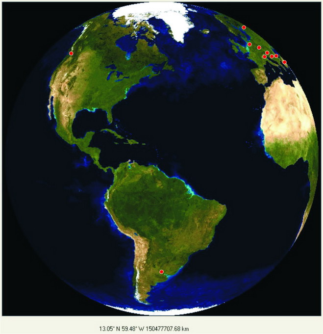
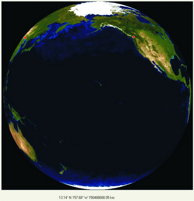
In order to determine the overall shape of the earth and to enable as many people as possible to participate the observations will be repeated at two additional moments:
 |
 |
|---|---|
| April 24th, 15.56 UT | April 24th, 22.29 UT |
At 15.56 UT, the sun will be perceived in the zenith of Bridgetown, Barbados. The third point of time has been chosen so that the sub-solar point is close to and exactly south of Hawaii. In Hawaii, the sun will be observed 8.2° from the zenith. To observe the sun in the zenith of Hawaii we would have to wait until May 27th.
The procedure of measuring is described in detail in a seperate page. Therefore, here only the essentials are listed:
Examples of Measurements and impressions of the experiments are shown in our impressions page.
For higher accuracy, it is better to mark some positions before and after t0.
The evaluation procedure is also described on the seperate page. List of essential topics: